Thursday, July 23, 2015

July 23rd

Off to Laverton to meet our travelling companions, Beth & John. We had a pleasant drive here this morning travelling on the old Laverton road. We stopped at various Lookouts and drove through a couple of old gold mining towns. In Mt Morgans the only well cared for building was the very old Municipal Chambers. The area was opened up for gold in the late 1890s. Mullock heaps both very large and very small were constantly part of the scenery. It is fascinating to see the display of earth colours which have been piled to make a mullock heap...colours ranging from grey green, through orange, grey to chocolate brown.

After finding Beth & John at the Caravan Park we enjoyed a picnic lunch together before spending a couple of hours shopping and filling EC with fuel and water so we will be ready to leave in the morning. My refrigerator is full to the door. It will require patience to find everything when needed.

There are many prospectors staying in the park. Some keen gold enthusiasts come to the area each year for several months of gold detecting. The elderly chap in the next caravan showed us his finds of gold. He had a small nugget about 3 cm x 2 cm. It is a new and interesting skill to learn. However I do nor intend taking it up as a hobby.

This evening we walked along the street to the local hotel- the Desert Inn. There were 2 bars for purchasing beer. This is rather confronting especially when aboriginal women and children wait at the door of the Pub. We spoke to them as we entered. There is definitely a saddening divide.

The meal was good but far too large for me. I hope there is walking to be done tomorrow. We will be up, up and away in the morning as we begin this long trip. We are looking forward to traversing the Great Victoria desert again. Hopefully there will be some wild flowers. We will be away from Telstra connection for some days so my blogs will not be posted.  Ilkurka is 900 km from here and will be the first place where fuel will be available for purchase. There is a small store at this junction/ John and I visited there about 3 years ago. Internet connection was available but the situation may have changed since then.

Brightly coloured rocks near Leonora

June & John with Beth & John at the Desert Inn, Laverton


Wednesday, July 22, 2015

July 22nd,

North to a small place on the map called Malcom. It has a very low water storage dam. The country has undulating low bush country with no flowers. We drove by a Shipping Container Trans Shipment Site..presumable servicing the mines.

We were pleased to arrive at Leonora and settle into the Caravan Park where I did 5 loads of washing and drying. It is so good to get practically everything  clean and dry. I feel I become quite paranoid about this aspect of camping. We are preparing to head east again on Friday with a 12 to 15 day trip without a reliable  opportunity to buy food. So the focus has been on the Supermarket which has quite a good range of food especially fresh fruit and vegetables. John has been 'sussing' out diesel prices and settled on paying $1.40 per litre. We now have both fuel tanks full and both water tanks full. To- morrow at Laverton we will fill five Jerry cans with diesel as well. We have 870 kms to travel to Ilkurlka where we can purchase fuel ..at what price?? I have purchased a lot of food this afternoon but will fill in the gaps at the Laverton Supermarket tomorrow. Everything is expensive but it is part of the holiday expenses.

This evening we walked up the street to the White House Hotel where we both enjoyed a delightful meal of fish. We have enjoyed returning to Leonora although there are few services here. I did go to the Chemist shop this afternoon. Sadly the windows are barred to protect against illegal entry after drugs.

John's cousin Lisa and here partner Tony are not in town this week. They accepted a gold detecting job with a Mining company. It is a shame we have not seen them again but a contract like this is very valuable to them.

There are no photos to post today but I am sure there will be plenty to see as we cross the Great Victoria Desert. I will be unable to post blogs for some days but hope to keep up my records and photos.
July 21st

The day dawned with a clear blue sky which soon clouded over and developed some very heavy sharp showers. There have been no wild flowers to mention over the last few days. After these heavy showers seeds should start to germinate.

We arrived at Niagara Dam late in the morning. It is a very rocky area. The rocks appear like ‘ironstone’. They look so rugged and dangerous to fall on. I must take care..not another slip!

After lunch we walked around the ‘Break Away Trail’ which goes around the small dam. The Niagara Dam was built during the late 1800s to supply the township of Niagara which was a busy mining area. The actual Niagara township only lasted for about 20 years before gold became scarce. The dam was not completed in time for use by these miners.

The short walk we took was dominated by rocks..their formation, their colour and the care needed to walk over them. The colours ranged from brown, tan, bright orange, white, cream and even some shades of deep red/purple..an artists delight. A deluge of water over them would be spectacular. At the time the dam wall was constructed a ‘Debris Trap’ was built as well with the aim to stop branches and other smaller debris being washed into the dam during a flood. The trap consists of a substantial iron fence consisting of uprights close together with a railing along the top and set into a concrete wall.

The afternoon improved and allowed us to light a fire and bake a loaf of Gluten Free bread for me. The shops are few and far between in the Inland and only a few have heard of GF products.

Niagara Dam

The GF bread part way through the cooking process.
John is still trying to identify Eucalypt trees. He works with a computer program which has an elimination process. There are so many different varieties. Even the Mallee trees which I am using for dyeing fabric are difficult to identify. There are 57 varieties of Mallee trees in the Murchison Bio-region alone, the region in which we were in, a couple of days ago. In total, there are approximately 100 eucalypt trees in that region. So many of them are similar..they may all have small leaves, cream trunks and tiny buds and nuts…where to next? If you are really keen you would need to compare the size and shape of the seeds or cut open the buds to see the different ways the flowers develop. I think we will leave many as unidentified.


July 20th

We awoke to an overcast morning with a few drops of rain..not only the sky was grey but the bush as well. If a quantity of rain falls the countryside will really love it. Today we saw the first very poor cattle for the trip.

We stopped in Menzies with the idea that there may be a grocery shop..only a Pub shop which keeps very few goods. However internet connection was strong enough for a phone call and a couple of blog postings.

On our way south out of Menzies there was a really smart sculpture which had been inspired by the the inland Australians and made with reverence to Antony Gormley. The artist Silvia Kennedy wanted to make an artwork which represented some of the characters of Menzies.

We came south to Goongarrie which was originally a gold mining area and then a sheep station. It was first known as ‘Roaring Gimlet’ due to the sound of the south westerly winds roaring through the gimlet trees. The  Goongarrie National Park was created in 1978 primarily as a representative area to conserve the flora and fauna of this ecological zone. The track in was easy travelling although it was not the main entrance track. The camp host, Paul, was very helpful. We camped near the old Shearers Cottage so we could light the donkey and heat water for a shower.

The fine rain continued but we decided to walk the 3 km track- ‘ Nganamarta Walk Trail. This took us 45 minutes. It is not spectacular country but having the opportunity to walk through it gave us an idea what the country is really like. One of the points of interest was a shallow old gold mining hole dug through granite and quartz. What a tough way to make money.


Paul returned with information about the area and took us to see a Sandlewood tree which we were not confident of identifying. He also showed us on the map cross country drive on which we could return to Menzies. We will decide in the morning because of the rain. It is nearly 6.00 pm and light rain has been falling for about an hour. The donkey is heating water for the shower which is inside the Cottage. There is no electricity so it will be a shower by torch light.  

Some time later...the shower was excellent with plenty of hot water which actually lasted until morning.
Shearers Cottage with EC parked at the front door.

Monday, July 20, 2015

July 19th
John collecting water at Mt Elvire Rock
A cool morning at nearly -1deg, but the day soon warmed up with a clear blue sky once again.
Sunday Morning With Macca! We rarely listen to Australia All Over when we are at home but we do enjoy it when we are on Safari. This morning Wendy Lugg was interviewed about an ANZAC Exhibition she had curated. It includes the first Red Cross Quilt that was made. Wendy tracked it down to Canada and flew across to bring it back to Australia. She now hopes to be able to buy this quilt for Australian ownership.

It was 42 km from Mt Elvire Homestead out to the Evanston/Menzies Road. This main road appeared to have been watered. We actually met the water tanker and John spoke, by radio, to the driver and asked him why he was watering the road? To keep the dust down, mate, and to keep the road together because of the large haulage trucks using the road. He was watering a 200 km stretch of road. How often do you water? 12 hours per day and 7 days per week.

There are mines in the area..we saw signs for the Macarthur Magnetite Mine. Further on we saw road works in progress..a grader, a water truck and a roller which was driven by a female. The soil was rich red in colour. John chatted to the grader driver who directed us through the grading and watering sections. We followed the Menzies/Sandstone Road which was bitumen and called into Snake Hill Lookout which gave an interesting view of this wide flat area of salt lakes and low bush.

We went in to see the Lake Ballard Art Australia Sculpture Precinct which is 51 kilometres west of the small township of Menzies. This incredible cultural display is situated within the eerie setting of Lake Ballard. They were made by Antony Gormley an internationally known sculptural artist. The work 'Inside Australia' was commissioned to mark the 50th Anniversary of the Perth International Arts Festival in 2003. The location of the display definitely adds to the whole concept. The cast metal figures are quite rusted and had been positioned at intervals across Lake Ballard. We walked out to see them but did not have a close look at each one because the lake was quite wet and muddy. The sculptures were slim male and female figures. We did not really understand them as they had little purpose or meaning to us.

 Before returning to EC we climbed the small island we had walked passed  It was very steep with slithering stones. We both reached the top for a magnificent view of Lake Ballard. Unfortunately on the way down, 5 steps from the bottom I slipped and took a little skin off. I was cross that my care had not avoided this incidence.

Female figure on Lake Ballard with small island in background

Male figure on Salt Lake Ballard

July 18th 

Mt Jackson Abandoned Homestead
Textile Wallhanging 'SALINA'

A lovely morning so we walked on the track for a km or so, returned to the truck and drove another 11 km through the Baladjie Lake Nature Reserve. The early morning bush was so very attractive with numerous Gimlet trees showing off their magnificent copper trunks. Gradually the trees changed to another species with white trunk, then changed back to copper Gimlets. From time to time we could see a large salt lake in the distance.

We followed the map in a northerly direction and went through the Barrier Fence again. The travelling was great with continuing woodlands of beautiful trees. The road took us across an expansive salt lake..an expansive Salina. Salt lakes always fascinate me so much so that I was inspired to make a wallhanging about them..see above
.
Mt Jackson has been a mining area but all that remains on the Station now is a derelict stone homestead. Such a shame as hard working people would have spent a lot of money, time and energy into building this home.

It was obvious that a lot of mining has happened in this area. By the quality of some of the roads we think that mining is still happening. We crossed an extremely smooth gravel road with Notices each way warning of NO ACCESS. We could hear machinery and then as we stopped for lunch on top of a rise my phone beeped with some messages. The Telstra waves gave us enough internet connection to send messages and post several blogs..an unexpected benefit.
John was aiming to camp at Elvire Station so on we drove through some more lovely woodlands. The trees we have seen today have really made an impression. They are just so attractive despite the dry climate. We have been able to identify a couple of new eucalypt trees as well.

Eventually we came to Elvire Conservation Park which was formerly a station property. The simple home was completely deserted and the surrounding land looked very barren and unattractive. The only aspect which appealed to us was a Break Away which was spectacular because of its varied and brightly coloured rock face. There were no trees close to where we camped so John was able to attach our clothesline to the rock face where the clothes dried in the late afternoon sun and should catch the morning sun as well.
Mt Elvire Break-Away clothes line


Saturday, July 18, 2015

July 17th

South to Beacon after a lovely campsite at Billburning Rock. We have had a great day, all very interesting and excellent roads to travel on.

Beacon is a very smart well cared for town. The school is quite large as in buildings, but with only 37 pupils in Prep to Year 7. There are 5 part time teachers. I imagine the children are being exposed to a wide education. After completing Year 7, children go off to Boarding School in Perth.

The General Store is very good so we have replenished our food supplies. John filled EC with fuel ..the cheapest we have had at $1.40 per litre.

The Information Centre has wonderful records of all the native trees of the area. We took some time looking over  the details about Eucalypts..in particular Mallee Eucalypts. There are nearly 20 different species. The collection consists of details of pressed flowers and leaves, photos, buds and nuts. All botanical details are recorded as well as the common names used for each tree. This project as well as the Botanical Park Project was developed about 20 years ago. The teachers and pupils at the school grew and planted many of these local trees into a Botanical Park. What a wonderful project for the school and the local community members to work together on.

A natural avenue of Gimlet trees.
After a couple of hours we headed east into ‘Gimlet’ country. These trees are absolutely sensational. I first saw them about 25 years ago, east of Norseman, and eventually made a wall quilt which was inspired by them, particularly the copper trunks. These trees have made our trip today quite spectacular. The bitumen road made its way through wide broad acre wheat crops. The town of Mukinbuden is a progressive little town as well with a camping ground, an IGA store and a Hardware shop.

 We continued on and eventually camped before we reached the town of Bullfinch. Lake Baladjie Nature Reserve has wonderful red soil growing typical Mallee scrub. We have our washing hanging on a line amongst the trees. It is a fine cool and peaceful night.

Gimlet tree showing fluted copper coloured trunk

July 16th

Farewell to Thundelarra Station after a very peaceful stay. We were quite impressed by the tidiness of the farmyard. Very many Station properties have an enormous amount of old rusty equipment and junk lying around which definitely detract from the appearance.

It was a thrill to see two Major Mitchell Cockatoos fly up as we departed. We have been expecting to see these large white and pink cockatoos in the inland. They are magnificent birds.

Thundelarra Station Homestead
A wide gravel road was a pleasure to drive on. Western Australia do have excellent roads..so many of them are gravel. The road curved through many salty clay pans and some very pretty range country until we came upon ‘Fields Find’ mining centre. We drove around the deserted area, taking note of mullock heaps, the old batteries, pit mines and a 6 metre deep mine shaft. The Cemetery was interesting a s well. The graves had been restored late last century. As always these old and remote cemeteries tell tales of hardship and disaster. Our friend Helen Brock can remember visiting this area as a child. I wonder what it was like then..about 60 years ago. How many people lived and worked these mines. We found it an interesting place to visit.

We noticed quite a number of Kurrajong trees among the mulgas. Some were growing on the road verge and the grader had carefully graded around them. They must be significant!

Payne’s Find Roadhouse was the next stop for us. A very simple shop with only a very few supplies and yes. I found a small packet of Liptons teabags which will last John a few days..we have saved disaster!

Several roads went south from Payne’s Find and eventually we found the one that led to Beacon. What a pretty drive as it led off beside Moore’s Lake. Or was it a mirage we could see. Distant water in the desert is quite disconcerting. This mirage even had a reflection of trees on the bank. Dry station properties consist of a lot of large salt pans or Salina (another name for salt lake) have a lot of Samphire growing on them. The colours are soft green/grey to s deep red/purple. It can be steamed and eaten as a vegetable. Maybe I did not need to buy that last lot of broccoli!

John spotted a Quandong tree. He has treid to grow them at Milawa without much success so he collected a bag of nuts to try again. There was fruit on the tree. I hoped that I would not be asked to make Quandong jam while out here. Many years ago when we were touring the Kimberleys we found a  wonderful crop of Rosellas. I had never heard of Rosella plants only Rosella birds. Anyway my friend Del and I made jam from this fruit. The boys had fun weighing the sugar and of course what jars would we put the finished jam in. It was delicious on our morning toast.

Eventually we came to the STATE BARRIER FENCE. It was constructed during the late 1950s to keep emus, goats and wild dogs out of farming areas. It was called a Vermin Proof Fence.

Our destination for the day was a very attractive camping area at Billiburning Rock which we climbed late in the day. It is a large rock area with smaller rocks scattered over it. The view from the top showed the surrounding large area of wheat crops. It is mallee country similar to the Victorian Mallee.


On the summit of Billiburning Rock
Foe several days we have been noticing a tree which we are not familiar with. Today our lunch spot was amongst a number of these lovely eucalypts. This evening John has identified it as eucalyptus loxophleba. It can grow as a tree or a mallee form with a lignotuber. This is exciting for me as it is different tree for me to select leaves for dyeing. 

Wednesday, July 15, 2015

July 15th

The Blue Sky has returned and the rain has moved eastward. How lucky for us as dry weather is much easier when you are camping.

The Mullewa area is undulating with crops growing well this season. Mullewa is a small township with few facilities..in fact the poorest Super Market I have seen. Hope we don't starve! John may have to drink green tea though. We went to the Info centre where the lady was very helpful and was able to identify a couple of the flowers in my photos. She also told us where to go to see the famous Wreath Flowers or Wreath Lechenaultia. Off we went to Pindar to find them. It is very early in the wildflower season for the wreaths to be very large and colourful. However we did see some lovely examples on the side of the road.

The roads are sealed so the driving to Yalgoo was made very easy. This little place is without many services either. From here we headed south to Payne's Find which is a Mining area. Along the way we saw the Golden Grove Mine. A large aeroplane was coming in to land..presumably returning staff to the mine after time off. The mine was near to Gnows Nest Range which consists of very rocky and rough 'jump ups' This evening I am probably linked into the Internet connection made available by this mine.

The roadside did not show so many flowers, in fact it was very bare in places. As we travelled over hill crests we could not help remarking 'what a big flat country this is!' All we could see was a landscape of low bushes.

The map noted that Thundelarra Station took Homestays and Campers so we drove the 11 km off the main road to the Station Homestead. The home was a modern 'rammed earth' building. The Station Manager's wife answered our knock. No, sadly they do not take Homestays at the moment, However she was very happy for us to camp in the Home Paddock. Evidently these new managers have only been in residence for about 10 days..what a mammoth task managing a big outback station.

Wreath Flower

Detail of Wreath Flower
July 14th

We expected to spend the whole day filling in time at Murchison Camping Ground , but by midday the word went round ‘The roads are open’ All campers were up, up and away as we were. I finished the washing and drying of sheets and towels. We had a take-away fish and chips for lunch and we went on our way as well. In total we had spent 24 hours at the settlement.

The road to Mullewa was bitumen for 2/3 of the way and good gravel for the rest. The causeway over the Sandford River was washed away, so we used the recently de-commissioned bridge to cross the river.  


Hakea recurva

The scenery was rather grey and uninteresting apart from a few flowers as we neared Mullewa. After crossing the Hacket Creek we turned into the Urawa Nature Reserve and drove a little way along the track by the river and camped the night. The bush was rather barren but there were some flowers, several of which I had not seen before.  The sky looks brighter so we hope the rain has moved further away.
PS The above Hakea which I photographed and showed the very knowledgeable lady at the Mullewa Info Centre was identified. It has 10cm long spiky and strong leaves. A warning the keep away! It has a beautiful flower though. 
July 13th

Pink carpet over a clay pan

Rain overnight. Do we travel these roads?? They are all gravel, there are creek crossings, have the rivers and creeks risen? There is no way we can find out as the Murchison Shire Council is not answering the number which John rang on the Satellite phone. Despite listening to the radio for about an hour we did not hear a report on roads.

At about 10.30 am we headed south to the Settlement of Murchison. Evidently the Murchison Shire, which is huge, is the only Shire in Australia which does not have a town. Overall the gravel road was excellent with only a few muddy patches. River and creek crossings were nearly all dry with only one having a steep descent to reach the causeway.

The grey clouded sky contributed to the dull scenery. The same bright mauve/pink ground cover, that we saw yesterday, was very obvious on the flat clay pans amongst the roadside bushes. The brilliant red Rosie Dock added a bright patch to road edges as well. There are some very attractive small Ghost gum Eucalypts dotted through the low bushes.

We had planned to turn off this road and take a minor road across to Cue. Some years ago we visited Walga Rock near Cue and were most impressed with the Aboriginal art work on a large rock gallery. Because of the uncertainty about road conditions we decided against doing this. This is rather disappointing as the drawings are really impressive.

We arrived at Murchison Settlement about 12.30 pm. At the entry to the streets and housing John had to move a ROAD CLOSED sign. Un-be known to us the road we travelled on had been closed. We could see another Road Closure sign ahead of us and on the road to Mullewa. We called at the Shire office to get the ‘truth of the matter’. We will not be going anywhere today!! Maybe we will not be going anywhere for several days. The rain is actually very light but it has been falling now for nearly 24 hours.


Several years ago when we were travelling with Razi and Terry, we spent 24 hours at the same camping ground because of flood waters. Since then, it appears, that all buildings have been renewed. The main Reception and Kiosk has been re-built of ‘rammed earth’ and adjacent buildings have been constructed in a smart new style.


July 12th

We left the beautiful Kennedy Range National park under grey skies with a forecast of rain. We were keen to go south to successfully cross the Gascoyne River before the rain eventuated. It was a wide crossing with ROAD CLOSED across the road. Many people have crossed this river despite the sign. We watched another vehicle cross successfully so we launched EC along the track across. There were no problems but after hearing everyone along the way commenting on this crossing it was good to have it behind us.

Gascoyne Junction is a very small settlement. We called at the Camping Park/ Fuel Station which had been washed away in floods some years ago. It has been rebuilt with lovely modern buildings and is most attractive. Probably the smartest new style park I have seen.

Telstra connection was available after about 5 days without it. We took some time to do messages and phone calls. Then off we went south with a cloudy sky and the forecast of rain. We have stopped at Bilung pool for the night, despite midgies and mossies. There are several other people camping here. One group is down in the gorge near the water. I would not be camping there with the threat of rain in the air.   The Bilung Gorge is most attractive and very wide. It would certainly be wild in a flood!

The scenery today had been rather dull without the masses of flowers although we found Rattle Pod Grevillias in bloom. There were some wonderful pink ‘ground cover’ plants flowering on clay pans. They were very bright, in fact quite luminous.

Crossing the Gascoyne

The Graders do a wonderful job with the many gravel roads in this area of Australia. Today, despite that it is Sunday, we caught up with the Grader. John always speaks to the driver on the radio and tells him what a great job he is doing. The reply is always appreciative with ‘have a good day eh!’ on the end.


Sunday, July 12, 2015

July 10th

An early walk was enjoyed before setting off for Kennedy Range. The walk in Gum Grove took about 30 minutes. The Red Gum trees were magnificent. The track rocky but clearly defined.

The anhu walking shoes I purchased before I left home are proving to be a very worthwhile investment. They are strong and comfortable for walking over the very rocky tracks we have been on.

There were not so many wild flowers today probably because of less rain on the area. However there were flower carpets of mauve (mulla mulla), bright pink (Swainsona or poison pea), Green grey  (green mulla mulla) and yellow (goodenia) The flat or undulating country was pleasant to drive through with medium to high bushes which I suspect were Mulga but very few Red Gums.
We crossed the Lyons River at the causeway which was about 25cm deep. The Lyons is a significant water way at this shire. There were many budgerigars twittering in the gum trees and looking for nesting holes.
Lunch was eaten on the side of the road at a spot very near to the most northerly point of out trip.

Still not many birds apart from several magnificent wedge tailed eagles soaring in the sky. There was a small flock of zebra finches in the trees as we entered the lovely  Kennedy National Park where we plan to stay for 2 nights.

Because of an unexpected shut down of my computer, the blog days have become out of order a little. Hope you can read them in sequence.
Me in Gum Grove

Crossing the Lyons River on the causeway.


July 11th

The walk up Temple Gorge, here in the Kennedy National Park was most enjoyable although I become tired of stepping up the large rocks---longer legs would be a help!

I decided to do some drawing while John walked up Draper’s Gorge. The rocks have many angles and crevices to draw and shadow. The completed drawing is actually an ‘impression’ rather then a realistic image. We watched small birds floating in the wind by the cliff face..an activity with no purpose but pleasure!

Mid afternoon we drove along the escarpment to Honeycomb Gorge. The rock formations are amazing and well worth photographing. We sat for ages, romancing about the Cathedrals of Europe which demonstrate a similarity to these rock formations.

While returning to our campsite we stopped to look at another site of Burrowing Bees. They are somewhat larger than the bees we have at home. They were playing ‘the mating game’ while we watched all the buzzing.

The Camp Host, Terry, lit the communal fire late in the day so we joined everyone for a drink and chat. They were a very pleasant group of people sitting around chatting about the outback and the rigs they have travelled in.
Male Burrowing bees waiting for the female Bee

Rock formations in Honeycomb Gorge


The camp ground is set near the escarpment among the Mulga trees. It is surprising how many camps are tucked away amongst the bush.  
July 9th
After 9 hours sleep we awoke refreshed and ready to explore the walking tracks around the
 Mt Augustus National Park. First we visited the Ooramboo walk where we viewed some very simple petroglyphs along an escarpment. John continued on up to Edney’s Lookout. I stayed and had an enjoyable study of the plants in the immediate area. I also had the pleasure of watching a pair of Budgerigars settling into a hollow branch. I imagine they were lining a nest prior to laying eggs.
We have found a few new plants today.. Native fig, growing from a crack in a huge rock, a Cow vine, one of many climbing in the trees. Small leaved Swainsona or Poison Pea, Wild parsnip, Hop Bush and a Lantern Flower were all new for this trip. It is astonishing the growth of plants in the area and most of them are in bloom.
Magnificent old Red Gum tree where budgerigars nest

Carpet of yellow Goodenia flowers

Masses of Cotton bush
The recent 60 mls of rain has been great for bringing the flowers into bloom.
We enjoyed several other walks including Flintstone, the Pound and the Cattle Pool on the Lyons River. The Pound was interesting because of its history. Early last century, the natural basin was used for holding cattle before moving them on hoof to Mekatharra. This droving excursion would take between 10 and 12 days.

This resort has been lovely to stay at. We have been allowed to camp in the nearby bush but still enjoy the pleasure of a hot shower. 
 There is plenty of water available although it is high in calcium.
July 8th
Mt Augustus
After camping in a secluded spot on the middle branch of the Gascoyne River we started on an excursion through Station properties to Mt Augustus. These properies and the homesteads are very remote. I cannot imagine living so far from neighbours and friends. We travelled over 300 km before we reached our destination shortly after lunch. The road was very good and led us through the most magnificent wild bush garden..I am envious as I would love such a garden around my own home! There were distant ranges in our view for most of the way, but the roadside green bushes and  flowers took our attention for most of the time. Blue, mauve, yellow, white, bright pink and everything in between made a glorious garden. I can identify many of them but the books I have do not answer all my queries. I asked the Volunteer Ranger at Mt Augustus about one bush which I thought to belong to the  Eremophila or Emu Bush family of plants. Yes, I was correct it was a Royal Poverty Bush (common name) These bushes were wide spread and different in size and height from each other. They looked a bit like a daphne bush from a distance. Another blue flower which appeared many times, I think was a Cattle bush despite the fact that cattle rarely feed on them.
There are very few birds to be seen other than galahs and a few kites and hawks although,


Wattle found near Mt Augustus
I did see a Red capped Robin and a tiny wren today. The wren was fawn/brown in colour with a distinctly blue colour in its erect tail. Again very hard to identify correctly when I am not a qualified ‘birdie’. We did not see another vehicle on the road for the whole way. There were a few kangaroos and a couple of small mobs of cattle which were sleek and fat. The rains have certainly suited this normally arid and barren area of Australia. About 100 km from Mt Augustus we crossed from the Meekatharra Shire into the Shire of Upper Gascoyne. They are both huge shires with many roads and river crossings to maintain ..especially after rains.
Mt Augustus appeared on the horizon.. the magnificent rock grew larger and larger as we approached. This rock is the World’s largest isolated monocline, twice the size of Ayers Rock and one billion years old. The shrubland around it is dominated by wattles ( acacias), eremophilas and cassias. Mulla Mulla and Pussy tails are in abundance as well. We drove the 49km loop around the sandstone and quartz massif with the plan to return tomorrow and explore some walks and gorges. One section of the road was cordoned because ‘Burrowing Bees’ were nesting. We had never heard of these before. Evidently this is the only area in the world where they are found. It was hard to feel comfortable amongst them even though the notice said that they do not bite. They were doing a lot of BUZZING though.

We walked over to the Bar at the reception area of the Resort before dinner. We were given free WYFI access when we purchased a drink. I was able to send and receive a few messages but not post this blog.
July 7th
Peace Gorge near Meekatharra is a really lovely place to camp. The morning and evening light on the large rocks is spectacular. We walked in the area and found a Minnie Ritchie/Red Mulga tree which is a type of type of Acacia. They are distinctive trees in the way the red bark curls. The walk to the top of the rise called Meeka Walk  was worthwhile for the view, especially the view of the open cut mine. The soil colours are surprising. Gold was found in the area in late 1903. After doing a few final shopping items we headed north for the Collier Ranges. The trip along the Great Northern Highway was really attractive with low bushes spreading across the country interspersed with many wild flowers..sometimes mauve and blue, sometimes yellow with acacia and cassia and lastly a wonderful white/snow carpet of white daisies. I think the rain which fell a few weeks ago has made the plants very green. There are some flowers that I cannot identify despite searching my wildflower books. I found one such bush today which had lovely dark red flowers and developed into white spotted petals.. a mystery bush especially as they were quite common.

This Great Northern Highway is very busy with Road Trains transporting goods of all kinds to those industries and people who are in northern Australia. I saw one Road Train with 9 Army Jeeps on it. There were huge tyres being transported and several half houses. The maximum length for a road train is 53.5 metres which is very long. While we were in the queue to get fuel in Meekatharra John  chatted to the chap who  was already filling his rig which weighed 120 tons and carried 1,500 litres of fuel. It had 4 trailers attached and the fuel rate was 1.1 kilometers per litre when loaded and 1.4 kilometres per litre when unloaded.

It is surprising how many people we speak to, here in the Gold field areas, because of the ‘lure of gold’ . Both  men and women spend weeks/months of the year camping and detecting gold and evidently quite successfully paying for their holidays.

Mid afternoon we arrived at the Kumarina Roadhouse. We expected to be able to find our way into the Collier Range National Park but staff at the Roadhouse told us there was NO ACCESS despite the fact that staff at the Meekatharra Shire offices had said we could enter this NP.
Peace Gorge near Meekatharra

Minnie Ritchie Tree

We re-assessed our plan and retraced our steps a few km and eventually took a road which we expect will take us to the Mt Augustus National Park. We actually came upon a couple of young chaps who had lost their positon on the map after taking a wrong turn. They were obviously pleased to see us. This evening we are camped on a secluded spot on the Gascoyne River. It is a huge water system with several arms. I think we are on the Middle Arm.


Monday, July 6, 2015

July 6th

What a beautiful BRAN NEW DAY after a very restful weekend at Lorna Glen. The property has no farm animals now and is operated as a Scientific research property. Matawa community care for the land and property in conjunction with the Department of Parks and Wildlife. Regular burning of areas for regeneration and as a method of averting wildfire still takes place. Sadly Dept of P & W still feel the need to lock sheds of equipment for safe keeping.

The morning drive out to the Highway did not seem as rough as when we came in. As always we found the morning scenery new and fresh. The Gunbarrel Highway begins from Wiluna and travels east. Rocky breakaways and red red sand dunes are a feature of this section of the Highway. Thryptomene bushes with mauve flowers stood out against the red sand.

As we neared Wiluna we took a track in to see a vineyard but found the vines to be old and uncared for - fresh fruit vines.

We stopped briefly at Wiluna and then headed for Meekatharra. I was keen to take a photo of the statue of 'Warri and Yatungka' before we left. In 1977 the last of the Nomads were brought in from the Western Desert. The story is told that as young people Yarri and Yatungka fell in love but Tribal Law forbade them from marrying as they were the wrong match according to 'skin group' law. The consequences for disobeying the law were severe. The lovers ran away and lived in isolation. They had 3 children together and it was not until the 1970s that a search went out for them because of drought conditions at the time. They were too shy to come in because they imagined the elders of their tribes would punish them for 'running away' together as they did. They found that the Elders and families had long ago forgiven them. Both Yarri and Yatungka died in 1979 just a few weeks apart.    I think this is quite a significant Australian story.

The road to Meekatharra was mostly lined with low bush country apart from the waterways where magnificent River red gums grow. The only excitement was one lone emu rushing across the road very unexpectedly. We nearly had another EMU EVENT.

Statue at Wiluna of the 'last nomads'

Peace Gorge where we are camped tonight
July 5th

Another warm day with plenty of flies! I was able to do a load of washing at Lorna Glen Homestead. It is always a bonus to find a washing machine. The weather was ideal for drying clothes which we did after we found a place to camp.
We only travelled about 30k m within the boundaries of the Lorna Glen Station. We are camped at a bore near the northern boundary. It was a  pretty drive up here with both rocky areas and other parts white with many wildflowers. I cannot identify them all and it is pointless to type all the names each day so I will adopt the policy of only printing the new or spectacular examples that we see.  Within the garden of flowers there were pink and white daisies as well as pink and white milk maids. The 60m of rain that has fallen recently has certainly brightened the desert.

Lorna Glen Station Homestead complex
 We drove by several bores and finally camped at No7. Bore. Clean water is plentiful if you care to work the hand pump. It was easy to have a shower on this very warm evening. I hope the rain that is forecast doesn’t catch us.

Some rocky country at Lorna
Stone Altar at Lorna Glen
July 4th

Soon after 6.00 am we decided to have a lay day here at Lorna Glen Camping area. We enjoyed a real ‘catch-up’ day and feel much rested this evening. It was a very warm day but relatively cool and pleasant in the shade. We walked for over half an hour, generally exploring the site. The camp hosts David and Corrie are very accommodating and visited us this morning and again this evening.
Yesterday Lorna Glen was declared an Indigenous Protection Area IPA. The MUTAWA people live nearby and are being trained in general maintenance of the property. There are a few flowers in bloom and some wonderful trees. A large old Desert red gum is near our camp. John estimates that it could be 500 years old. The red gums in NE Victoria are Eucalyptus camaldulensis camaldulensis and these desert red gums are Eucalyptus camaldulensis obtusa. The main differences are in the bud cap and white colour of the trunks of the desert variety.

The airstrip is a magnificent runway of fine red gravel against the blue of the desert sky.
While walking we discovered a hand made stone altar with rough seats for a congregation. This was built some years ago for the use by the 6 families who were living on the station at that time. 

Lorna Glen Airstrip

Desert Red Gum tree


July 3rd

Again we walked around the old home at Wanjarri Station. It all appeared so desolate. The goanna, and probably his mates have left wonderful tracks in the fine gravel. Kangaroos have been about as well, but we have not seen them.

The road back out to the highway was slow over the very rough rocky surface.
The Goldfields Highway is bitumen so we were soon passing the Mt Keith Nickel Mine with its huge mullock heaps.

The EC cabin is again full of branches from the Mallee eucalypt found at Wanjarri.  I clip the leaves as we travel ready for dyeing on my return home. I am concentrating on the Mallee family for a book project. John is able to identify most of them as long as we can find enough information about each variety. At least we need the leaves, nuts and buds. The trunk type and shape is useful as well.
We also have Native Pear this morning, along with its oval shaped green fruit.  Evidently the aboriginals roasted them and ate them and they proved to be a good source of nutrition.

The small water courses that we cross all have a good lush growth of trees many of which are the very distinctive Desert Red Gums.

John and I have visited Wiluna some 20 years ago and today it has many new services and appears to be a much tidier township. The Wiluna Traders is a very good Supermarket so we stocked up on a few necessary supplies. Calling at the Shire Offices proved to be a good move as the lady receptionist was able to tell us a lot about the area as well as the Art Gallery at the rear of the building. We saw some really lovely paintings which have been done by local aboriginal artists. A very distinctive style of art is produced by the group of artist who work through this gallery. Tjukurba Artists are called Birrilibura Artists.

We left Wiluna at about 2.00 pm and took well over 2 hours to reach Lorna Glen where we planned to camp the night. The road was rough and corrugated in places but the scenery quite picturesque with Marble gums, a huge variety of acacias, thryptomene and very green, healthy looking Spinifex.
The juvenile marbel gums are particularly attractive with round blue/glaucous leaves. The recent rains have made Lorna Glen desert area very green.

Hakea (Corkwood) blooms 

Trunk of the Hakea (Corkwood) tree

Our camp is in a clean flat area and there is plenty available artisan water of good quality.


Thursday, July 2, 2015

July 2nd

Despite a forecast of rain for this area we have had an early morning clear sky with a brilliant orange sunrise.
John has now exchanged the problem tyre for one of our spares. Driving is much more comfortable. We have a wonderful wide red gravel road to travel on. The surrounding country is covered in healthy bushes and flowers... Emu bushes, mulga trees, mint bushes, white everlastings, desert grevillias, grass trees, spinefix, silver cassia, cotton bush and Hakea Francisiana.

There was only one section of rough and bony road otherwise we have had an excellent run with a few kilometers of bitumen on the Goldfields Highway before we entered the Wanjarri Nature Reserve where we have camped this evening. Again this is an abandoned property. The old corrugated iron home must have made for very simple living. There is one huge room with a large fire place in the middle. John has lit the fire which persists in smoking but he has the camp oven over the flames...cooking our dinner of beef stew, I hope.

There is a resident goanna living near the house. He is in and out of his hiding hole and we can see his tracks about in the sand. He is very camera shy.

The evening is cooler with a bright moon.
Winjarri deserted Homestead

Cooking dinner over inside fire

Goanna with beautiful markings
July 1st
Sunrise reflections on dappled clouds
What a wonderful sunrise. We had camped near Mt Forest on the Sandstone Menzies Road. The rising sun produced bright red/pink reflections on the dappled cloud.
Two cars went by during the early dark last night. These were the only vehicles we saw since midday .
We drove through Noondie Lakes—a large dry salt lake system with dark red Samphire growing nearly all over it.
As we neared Sandstone, much of the road was lined with thick low bush. Sandstone is a  small township which is kept very clean and gardens are well cared for. We found a couple of Eucalypt  Macrocarpa trees growing quite happily. I would love to find one growing in the wild and in bloom. The buds are silver in colour and burst into large red blooms. The nuts are 3-4 cm in size. John has collected a couple with the hope of growing a tree at Milawa. We collected some dry leaves for me to ECO dye with. We thought it was too cheeky to collect a branch from these cultivated trees in the middle of the township.
We explored the heritage trail which was quite interesting with an old mine, an old Brewery in a cave, an old well out on the main road and London Bridge which is a rock formation in the shape of  a bridge.
We ate our lunch under the shade of a Kurrajong tree in the middle of town and purchased some supplies from the store in the Pub. The weather was delightful at 24+ deg.
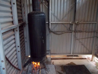
Our camp tonight is at an old property called Lake Mason. Shearing Shed, workers quarters, homestead and windmill are still there. I find it sad when a homestead has been deserted. I lit the hot water donkey and showered in the available facility. It was a very successful shower. The area is now a National Park so it was good to see everything being cared for so well. It is very arid country and hard to believe that sheep were grazed here. Gidgee trees grow easily but they do have a very pungent smell.


'Donkey' heater and shower room

Wednesday, July 1, 2015

June 30th

Our new tyre arrived in Leonora about 10.45 am. The mechanics took about an hour to do the fitting work and add balancing beads to the right front tyre. We were advised to travel about 100 km before we could make a proper judgement about the unbalanced wheel. The result does not seem to be satisfactory which makes it tiring for John to drive. We stopped just off the road and camped. Two Kangaroos guided us in. The first kangaroos we have seen since leaving SA.
We travelled a wide red road as we left Leonora towards Mt Ida which is near Wilbah Station. An Uncle of a friend of ours, Terry Wight, operated this cattle Station during the early part of last century. He had to leave it because of drought conditions. Today, the bush looks healthy after recent rains, even the Spinifex looks green.
There are extensive systems of salt lakes, some of which are showing a growth of very healthy Samphire. Overall we have seen very few birds but today were lucky to see 3 Magpie Geese fly up from a wet area in a salt lake.
We have not seen a vehicle or a person since leaving Leonora and travelling 200 km. It is a very remote area in which we are camped tonight. I think in earlier days there were gold mining centres, a couple of which we passed by during the day. When we went by the Copperfield Mine we discussed whether it would be a gold mine or a copper mine. The information board told us that the young man who found the first gold in the area was reading ‘David Copperfield’ at the time..hence the name. I imagine the only time he had to read the book was at night and the only light available would have been a candle. I bet the print in the book was very small as well.
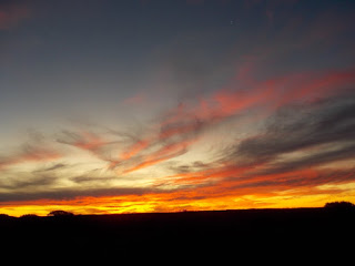
Cirrus clouds are in the blue sky this evening and they have added to a beautiful sunset. I hope they are not a forerunner of a rain event.


Bush camp north of Leonora & south of Sandstone

The last sunset for the month of June